
Thank you for supporting this site ❤️
Make a donation
Make a donation
Gear up for your next adventure:
As an Amazon Associate, this site earns from qualifying purchases at no extra cost to you.
Yacuanquer topographic map
Click on the map to display elevation.
Thank you for supporting this site ❤️
Make a donation
Make a donation
Gear up for your next adventure:
As an Amazon Associate, this site earns from qualifying purchases at no extra cost to you.
About this map
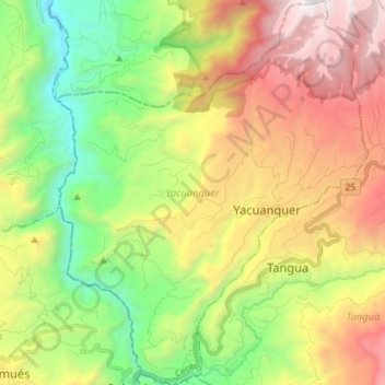
Name: Yacuanquer topographic map, elevation, terrain.
Location: Yacuanquer, Centro, Nariño, Colombia (1.05101 -77.47943 1.19303 -77.36447)
Average elevation: 7,933 ft
Minimum elevation: 4,275 ft
Maximum elevation: 12,861 ft
Thank you for supporting this site ❤️
Make a donation
Make a donation
Gear up for your next adventure:
As an Amazon Associate, this site earns from qualifying purchases at no extra cost to you.