
Pontaury topographic map
Interactive map
Click on the map to display elevation.
About this map
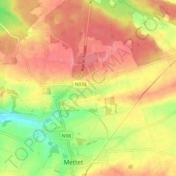
Name: Pontaury topographic map, elevation, terrain.
Location: Pontaury, Mettet, Namur, Wallonie, 5640, Belgique (50.31812 4.64376 50.35812 4.68376)
Average elevation: 823 ft
Minimum elevation: 673 ft
Maximum elevation: 922 ft
Other topographic maps
Click on a map to view its topography, its elevation and its terrain.
Aux Cloquettes
Belgique > Namur > Namur > Mettet > Aux Cloquettes
Aux Cloquettes, Mettet, Namur, Wallonie, 5640, Belgique
Average elevation: 817 ft