
Rochelinval topographic map
Interactive map
Click on the map to display elevation.
About this map
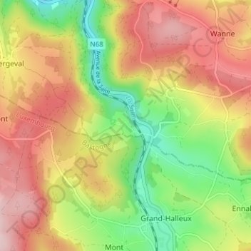
Name: Rochelinval topographic map, elevation, terrain.
Location: Rochelinval, Trois-Ponts, Verviers, Luik, Wallonië, 4980, België (50.32106 5.87703 50.36106 5.91703)
Average elevation: 1,329 ft
Minimum elevation: 873 ft
Maximum elevation: 1,765 ft
Other topographic maps
Click on a map to view its topography, its elevation and its terrain.
Brume
België > Luik > Verviers > Trois-Ponts
Brume, Trois-Ponts, Verviers, Luik, Wallonië, 4983, België
Average elevation: 1,142 ft