
Vigneulles-lès-Hattonchâtel topographic map
Interactive map
Click on the map to display elevation.
About this map
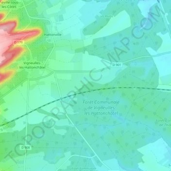
Name: Vigneulles-lès-Hattonchâtel topographic map, elevation, terrain.
Average elevation: 797 ft
Minimum elevation: 705 ft
Maximum elevation: 1,237 ft
La commune fait partie du Parc naturel régional de Lorraine et est situé à 261 m d'altitude.