
Humedales de Puerto Viejo topographic map
Interactive map
Click on the map to display elevation.
About this map
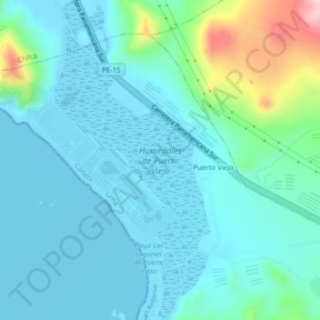
Name: Humedales de Puerto Viejo topographic map, elevation, terrain.
Location: Humedales de Puerto Viejo, San Antonio, Cañete, Lima, Perú (-12.58957 -76.71545 -12.55174 -76.69652)
Average elevation: 135 ft
Minimum elevation: -3 ft
Maximum elevation: 787 ft
Other topographic maps
Click on a map to view its topography, its elevation and its terrain.
Puerto Viejo
Perú > Lima > San Antonio
Puerto Viejo, San Antonio, Cañete, Lima, Perú
Average elevation: 184 ft
Playa León Dormido
Perú > Lima > San Antonio
Playa León Dormido, Carretera Panamericana Sur, Condominio Costa del Campo, San Antonio, Cañete, Lima, Perú
Average elevation: 167 ft