Geolocate

Foz topographic map

Click on the map to display elevation.

About this map
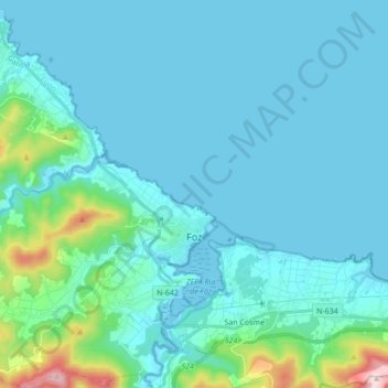
Name: Foz topographic map, elevation, terrain.

Location: Foz, A Mariña Central, Lugo, Galicia, Spain (43.52044 -7.40283 43.64477 -7.24467)

Average elevation: 187 ft

Minimum elevation: -7 ft

Maximum elevation: 1,647 ft

Other topographic maps

Click on a map to view its topography, its elevation and its terrain.

A Lapa

Spain > Galicia > A Mariña Central > Ferreira

Average elevation: 551 ft

Gear up for your next adventure:

🥘Titanium Cookware - Durable, featherlight pots and pans for backpacking
🗻Climbing Gear Basics - Essential gear for beginner climbers
🧭Map Reading Tools - Tools and kits for map navigation
🔪Outdoor Multitools - Essential survival tools for gear repair and field use
🎒Gear Packing Cubes - Organize your backpack efficiently

As an Amazon Associate, this site earns from qualifying purchases at no extra cost to you.