
The Farms topographic map
Interactive map
Click on the map to display elevation.
About this map
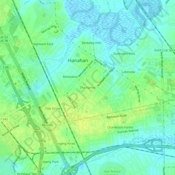
Name: The Farms topographic map, elevation, terrain.
Location: The Farms, Berkeley County, South Carolina, 29410, USA (32.88767 -80.02620 32.92767 -79.98620)
Average elevation: 26 ft
Minimum elevation: -10 ft
Maximum elevation: 59 ft