Geolocate

Boyeros topographic map

Click on the map to display elevation.

About this map
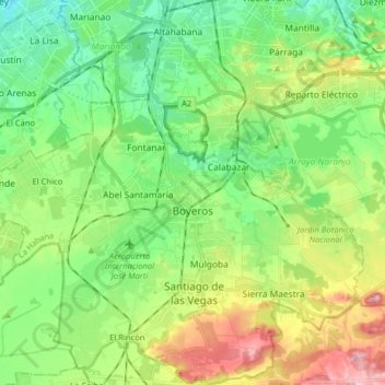
Name: Boyeros topographic map, elevation, terrain.

Location: Boyeros, Marianao, Havana, Cuba (22.93371 -82.47346 23.08034 -82.31720)

Average elevation: 253 ft

Minimum elevation: 36 ft

Maximum elevation: 682 ft

Gear up for your next adventure:

🔊Portable Camp Speaker - Music and alerts at camp
🥾Men's Hiking Boots - Durable, waterproof footwear for rugged terrain and steep inclines
🔭Compact Binoculars - HD vision for scouting terrain and identifying distant landmarks
🧢Sun Protection Hats - Wide-brimmed and UPF-rated hats for high-altitude sun safety
🧦Merino Wool Socks - Moisture-wicking, blister-preventing socks for long treks

As an Amazon Associate, this site earns from qualifying purchases at no extra cost to you.