Geolocate

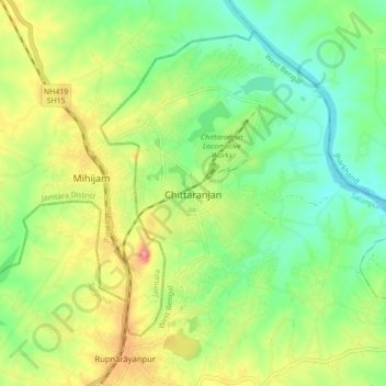
Chittaranjan topographic map

Click on the map to display elevation.

Chittaranjan

Chittaranjan is located at 23°52′N 86°52′E / 23.87°N 86.87°E / 23.87; 86.87. It has an average elevation of 155 metres (508 feet).

Wikipedia (CC-BY-SA 3.0)

About this map

Name: Chittaranjan topographic map, elevation, terrain.

Location: Chittaranjan, Salanpur, Paschim Bardhaman District, West Bengal, 713331, India (23.80916 86.86189 23.88916 86.94189)

Average elevation: 512 ft

Minimum elevation: 377 ft

Maximum elevation: 719 ft

Gear up for your next adventure:

🛏️Cold Weather Sleeping Bag - Warm sleeping bag for cold conditions
🛡️Insect Repellent - Protection against bugs during outdoor activities
📶Vehicle Signal Boosters - Improve reception in rural areas while driving to trailheads
🌎3D Topographic Globes - Raised relief globes for a tactile understanding of geography
🧢Sun Protection Hats - Wide-brimmed and UPF-rated hats for high-altitude sun safety

As an Amazon Associate, this site earns from qualifying purchases at no extra cost to you.