
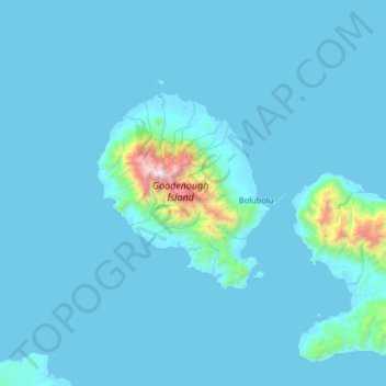
Goodenough-Insel topographic map
Interactive map
Click on the map to display elevation.
About this map
Name: Goodenough-Insel topographic map, elevation, terrain.
Average elevation: 338 ft
Minimum elevation: -3 ft
Maximum elevation: 8,136 ft
Other topographic maps
Click on a map to view its topography, its elevation and its terrain.
D’Entrecasteaux Islands
D’Entrecasteaux Islands, Esa’ala District, Milne Bay, Papua Region, Papua-Neuguinea
Average elevation: 335 ft
Fergusson-Insel
Fergusson-Insel, Esa’ala District, Milne Bay, Papua Region, Papua-Neuguinea
Average elevation: 322 ft