

Amersfoort topographic map
Click on the map to display elevation.
Amersfoort
The construction of the tower and the church was started in 1444. The church was destroyed by an explosion in 1787, but the tower survived, and the layout of the church still can be discerned today through the use of different types of stone in the pavement of the open space that was created. It is now the reference point of the RD coordinate system, the coordinate grid used by the Dutch topographical service: the RD coordinates are (155.000, 463.000).
About this map
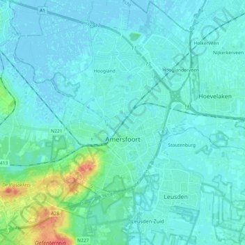
Name: Amersfoort topographic map, elevation, terrain.
Location: Amersfoort, Utrecht, Netherlands (52.10838 5.30646 52.21915 5.47992)
Average elevation: 23 ft
Minimum elevation: -10 ft
Maximum elevation: 171 ft