
Aner topographic map
Interactive map
Click on the map to display elevation.
About this map
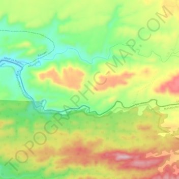
Name: Aner topographic map, elevation, terrain.
Location: Aner, Jalgaon, Maharashtra, 425001, India (21.37414 75.61467 21.38911 75.67105)
Average elevation: 2,165 ft
Minimum elevation: 1,745 ft
Maximum elevation: 2,641 ft
Other topographic maps
Click on a map to view its topography, its elevation and its terrain.
Bahula
India > Maharashtra > Jalgaon
Bahula, Jalgaon, Maharashtra, 425001, India
Average elevation: 794 ft