
Kosrae topographic map
Interactive map
Click on the map to display elevation.
About this map
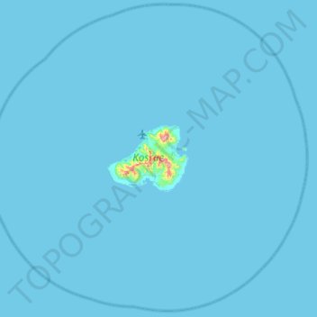
Name: Kosrae topographic map, elevation, terrain.
Location: Kosrae, Federated States of Micronesia (5.05900 162.69808 5.56900 163.23641)
Average elevation: 13 ft
Minimum elevation: 0 ft
Maximum elevation: 1,883 ft
Other topographic maps
Click on a map to view its topography, its elevation and its terrain.
Kosrae
Federated States of Micronesia > Kosrae > Utwe
Kosrae, Utwe, Kosrae, 96944, Federated States of Micronesia
Average elevation: 184 ft
Utwe
Federated States of Micronesia > Kosrae > Utwe
Utwe, Kosrae, Federated States of Micronesia
Average elevation: 30 ft