
Acatlán de Juárez topographic map
Interactive map
Click on the map to display elevation.
About this map
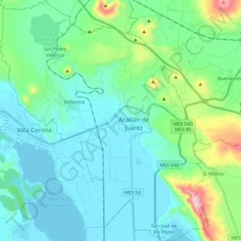
Name: Acatlán de Juárez topographic map, elevation, terrain.
Location: Acatlán de Juárez, Jalisco, Mexico (20.34221 -103.68842 20.50569 -103.53626)
Average elevation: 4,869 ft
Minimum elevation: 4,416 ft
Maximum elevation: 6,916 ft