
Albudeite topographic map
Interactive map
Click on the map to display elevation.
About this map
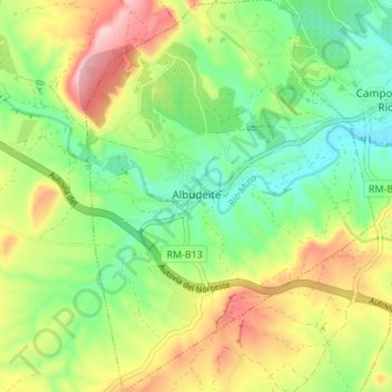
Name: Albudeite topographic map, elevation, terrain.
Location: Albudeite, Río Mula, Región de Murcia, España (38.00051 -1.40476 38.05417 -1.35451)
Average elevation: 774 ft
Minimum elevation: 492 ft
Maximum elevation: 1,201 ft