
Columbiana topographic map
Interactive map
Click on the map to display elevation.
About this map
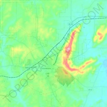
Name: Columbiana topographic map, elevation, terrain.
Location: Columbiana, Shelby County, Alabama, 35051, United States (33.14237 -86.65761 33.24170 -86.55690)
Average elevation: 554 ft
Minimum elevation: 404 ft
Maximum elevation: 948 ft