
Thank you for supporting this site ❤️
Make a donation
Make a donation
Gear up for your next adventure:
As an Amazon Associate, this site earns from qualifying purchases at no extra cost to you.
91352 topographic map
Click on the map to display elevation.
Thank you for supporting this site ❤️
Make a donation
Make a donation
Gear up for your next adventure:
As an Amazon Associate, this site earns from qualifying purchases at no extra cost to you.
About this map
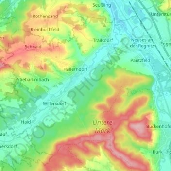
Name: 91352 topographic map, elevation, terrain.
Location: 91352, Hallerndorf, Landkreis Forchheim, Bavaria, Germany (49.71666 10.91301 49.78602 11.04362)
Average elevation: 965 ft
Minimum elevation: 804 ft
Maximum elevation: 1,257 ft
Thank you for supporting this site ❤️
Make a donation
Make a donation
Gear up for your next adventure:
As an Amazon Associate, this site earns from qualifying purchases at no extra cost to you.