
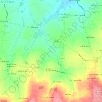
Sainte-Marie-du-Bois topographic map
Interactive map
Click on the map to display elevation.
About this map
Name: Sainte-Marie-du-Bois topographic map, elevation, terrain.
Average elevation: 482 ft
Minimum elevation: 328 ft
Maximum elevation: 699 ft
Other topographic maps
Click on a map to view its topography, its elevation and its terrain.
Le Domaine
France > Normandie > Manche > Le Teilleul
Le Domaine, Le Teilleul, Avranches, Manche, Normandie, France métropolitaine, 50640, France
Average elevation: 548 ft
La Butte Rouge
France > Normandie > Manche > Le Teilleul
La Butte Rouge, Le Teilleul, Avranches, Manche, Normandie, France métropolitaine, 50640, France
Average elevation: 577 ft
Le Teilleul
France > Normandie > Manche > Le Teilleul
Le Teilleul, Avranches, Manche, Normandie, France métropolitaine, 50640, France
Average elevation: 554 ft