
Thank you for supporting this site ❤️
Make a donation
Make a donation
Gear up for your next adventure:
As an Amazon Associate, this site earns from qualifying purchases at no extra cost to you.
Espinavell topographic map
Click on the map to display elevation.
Thank you for supporting this site ❤️
Make a donation
Make a donation
Gear up for your next adventure:
As an Amazon Associate, this site earns from qualifying purchases at no extra cost to you.
About this map
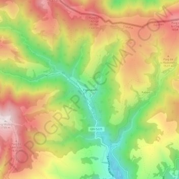
Name: Espinavell topographic map, elevation, terrain.
Location: Espinavell, Molló, Ripollès, Girona, Catalonia, 17868, Spain (42.35811 2.37856 42.39811 2.41856)
Average elevation: 4,695 ft
Minimum elevation: 3,629 ft
Maximum elevation: 5,696 ft
Thank you for supporting this site ❤️
Make a donation
Make a donation
Gear up for your next adventure:
As an Amazon Associate, this site earns from qualifying purchases at no extra cost to you.