
Murska Sobota topographic map
Interactive map
Click on the map to display elevation.
About this map
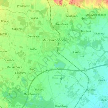
Name: Murska Sobota topographic map, elevation, terrain.
Location: Murska Sobota, Mura Statistical Region, Slovenia (46.59968 16.09823 46.69922 16.23762)
Average elevation: 620 ft
Minimum elevation: 577 ft
Maximum elevation: 722 ft