
豐年里 topographic map
Interactive map
Click on the map to display elevation.
About this map
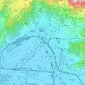
Name: 豐年里 topographic map, elevation, terrain.
Location: 豐年里, 田心仔, District de Beitou, 臺北市, 11263, Taïwan (25.11493 121.47415 25.15493 121.51415)
Average elevation: 236 ft
Minimum elevation: -7 ft
Maximum elevation: 1,552 ft