
Jambes topographic map
Interactive map
Click on the map to display elevation.
About this map
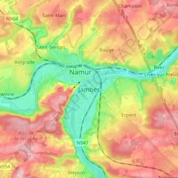
Name: Jambes topographic map, elevation, terrain.
Location: Jambes, Namur, Wallonia, 5100, Belgium (50.41896 4.83233 50.49896 4.91233)
Average elevation: 489 ft
Minimum elevation: 223 ft
Maximum elevation: 732 ft