
Make a donation
Gear up for your next adventure:
As an Amazon Associate, this site earns from qualifying purchases at no extra cost to you.
Itzehoe topographic map
Click on the map to display elevation.
Make a donation
Gear up for your next adventure:
As an Amazon Associate, this site earns from qualifying purchases at no extra cost to you.
Itzehoe
Itzehoe Castle was first mentioned in 1168 as “Echeho.” The town of Itzehoe (‘Opidium Ekeho’) was first mentioned by Saxo Grammaticus in 1196. Later it was mentioned again as ‘de Ezeho’. The meaning of the name is still disputed today. The component -hoe seems most likely to describe an elevation or raised river bend and to be related to the -Hoo, -ho or -hoe names found in England (‘Sutton Hoo’, ‘Ivinghoe'). The first part, ‘Etze-’, ‘Eche-’ or “Itze-”, is associated either with a pasture or the Old Saxon word for ‘oak’.
Make a donation
Gear up for your next adventure:
As an Amazon Associate, this site earns from qualifying purchases at no extra cost to you.
About this map
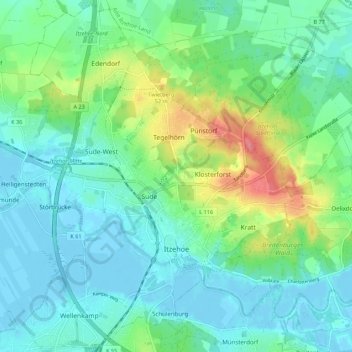
Name: Itzehoe topographic map, elevation, terrain.
Location: Itzehoe, Kreis Steinburg, Schleswig-Holstein, 25524, Germany (53.90141 9.46971 53.96419 9.57892)
Average elevation: 62 ft
Minimum elevation: -13 ft
Maximum elevation: 236 ft
Make a donation
Gear up for your next adventure:
As an Amazon Associate, this site earns from qualifying purchases at no extra cost to you.