
Ketzin/Havel topographic map
Interactive map
Click on the map to display elevation.
About this map
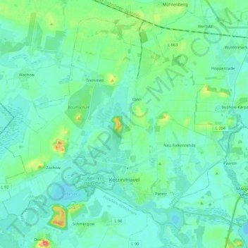
Name: Ketzin/Havel topographic map, elevation, terrain.
Location: Ketzin/Havel, Havelland, Brandenburg, 14669, Deutschland (52.45031 12.73411 52.56171 12.94713)
Average elevation: 118 ft
Minimum elevation: 82 ft
Maximum elevation: 276 ft
Other topographic maps
Click on a map to view its topography, its elevation and its terrain.
Falkenrehde
Deutschland > Brandenburg > Ketzin/Havel
Falkenrehde, Ketzin/Havel, Havelland, Brandenburg, Deutschland
Average elevation: 115 ft