
Fonte topographic map
Interactive map
Click on the map to display elevation.
About this map
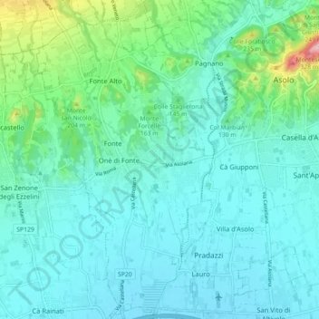
Name: Fonte topographic map, elevation, terrain.
Location: Fonte, Treviso, Véneto, 31010, Itália (45.75421 11.84537 45.81615 11.89573)
Average elevation: 390 ft
Minimum elevation: 243 ft
Maximum elevation: 1,109 ft
Other topographic maps
Click on a map to view its topography, its elevation and its terrain.