
Area A (Hudson Bay Mountain) topographic map
Interactive map
Click on the map to display elevation.
About this map
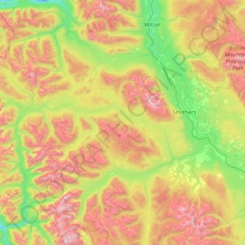
Name: Area A (Hudson Bay Mountain) topographic map, elevation, terrain.
Average elevation: 3,635 ft
Minimum elevation: 755 ft
Maximum elevation: 8,819 ft
Other topographic maps
Click on a map to view its topography, its elevation and its terrain.
Fraser Lake
Canada > British Columbia > Regional District of Bulkley-Nechako
Fraser Lake, Regional District of Bulkley-Nechako, British Columbia, Canada
Average elevation: 2,703 ft
Fort St. James
Canada > British Columbia > Regional District of Bulkley-Nechako
Fort St. James, Regional District of Bulkley-Nechako, British Columbia, Canada
Average elevation: 2,726 ft