
Thank you for supporting this site ❤️
Make a donation
Make a donation
Gear up for your next adventure:
As an Amazon Associate, this site earns from qualifying purchases at no extra cost to you.
Bodenmais topographic map
Click on the map to display elevation.
Thank you for supporting this site ❤️
Make a donation
Make a donation
Gear up for your next adventure:
As an Amazon Associate, this site earns from qualifying purchases at no extra cost to you.
About this map
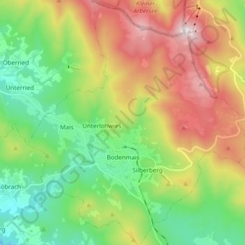
Name: Bodenmais topographic map, elevation, terrain.
Location: Bodenmais, Landkreis Regen, Bavaria, 94249, Germany (49.03481 13.04685 49.12363 13.16839)
Average elevation: 2,799 ft
Minimum elevation: 1,581 ft
Maximum elevation: 4,741 ft
Thank you for supporting this site ❤️
Make a donation
Make a donation
Gear up for your next adventure:
As an Amazon Associate, this site earns from qualifying purchases at no extra cost to you.