
Sants topographic map
Interactive map
Click on the map to display elevation.
About this map
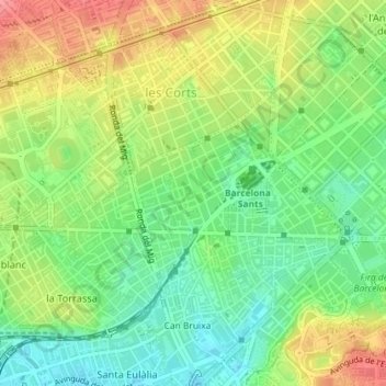
Name: Sants topographic map, elevation, terrain.
Average elevation: 161 ft
Minimum elevation: 36 ft
Maximum elevation: 322 ft
Other topographic maps
Click on a map to view its topography, its elevation and its terrain.
Vallcarca i els Penitents
Vallcarca i els Penitents, Gràcia, Barcelona, Barcelonés, Barcelona, Cataluña, 08023, España
Average elevation: 564 ft