
朋普镇 topographic map
Interactive map
Click on the map to display elevation.
About this map
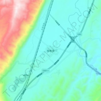
Name: 朋普镇 topographic map, elevation, terrain.
Location: 朋普镇, 弥勒市, 红河哈尼族彝族自治州, 云南省, 中国 (23.92684 103.30869 24.00684 103.38869)
Average elevation: 4,196 ft
Minimum elevation: 3,589 ft
Maximum elevation: 6,345 ft
Other topographic maps
Click on a map to view its topography, its elevation and its terrain.