
Opglabbeek topographic map
Interactive map
Click on the map to display elevation.
About this map
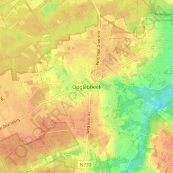
Name: Opglabbeek topographic map, elevation, terrain.
Location: Opglabbeek, Oudsbergen, Limbourg, Flandre, 3660, Belgique (51.02299 5.56196 51.06299 5.60196)
Average elevation: 256 ft
Minimum elevation: 177 ft
Maximum elevation: 292 ft