
Aizkorri topographic map
Interactive map
Click on the map to display elevation.
About this map
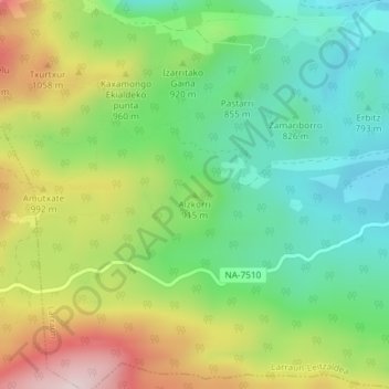
Name: Aizkorri topographic map, elevation, terrain.
Location: Aizkorri, Larraun, Navarra, España (42.97444 -1.95261 42.97454 -1.95251)
Average elevation: 2,917 ft
Minimum elevation: 2,352 ft
Maximum elevation: 3,829 ft
Other topographic maps
Click on a map to view its topography, its elevation and its terrain.