
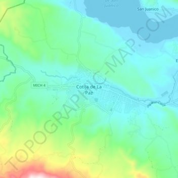
Cotija de La Paz topographic map
Interactive map
Click on the map to display elevation.
About this map
Name: Cotija de La Paz topographic map, elevation, terrain.
Location: Cotija de La Paz, Cotija, Michoacán de Ocampo, México (19.76847 -102.74418 19.84847 -102.66418)
Average elevation: 5,801 ft
Minimum elevation: 5,253 ft
Maximum elevation: 7,831 ft