
Cul-des-Sarts topographic map
Interactive map
Click on the map to display elevation.
About this map
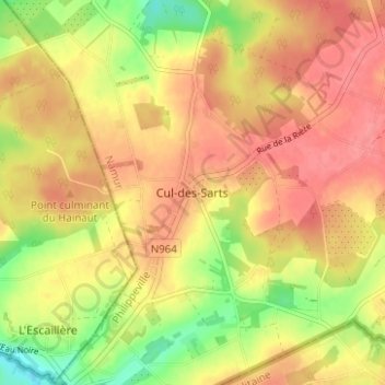
Name: Cul-des-Sarts topographic map, elevation, terrain.
Location: Cul-des-Sarts, Couvin, Namen, Wallonië, 5660, België (49.94154 4.43500 49.98154 4.47500)
Average elevation: 1,155 ft
Minimum elevation: 1,020 ft
Maximum elevation: 1,237 ft