
Lansingerland topographic map
Interactive map
Click on the map to display elevation.
About this map
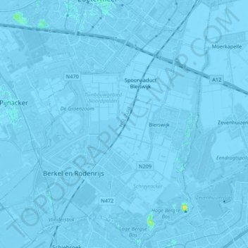
Name: Lansingerland topographic map, elevation, terrain.
Location: Lansingerland, South Holland, Netherlands, The Netherlands (51.96029 4.42422 52.06174 4.56520)
Average elevation: -10 ft
Minimum elevation: -30 ft
Maximum elevation: 69 ft
Dutch Topographic map of the municipality of Lansingerland, June 2015
Other topographic maps
Click on a map to view its topography, its elevation and its terrain.
Berkel en Rodenrijs
The Netherlands > South Holland > Lansingerland
Berkel en Rodenrijs, Lansingerland, South Holland, Netherlands, The Netherlands
Average elevation: -10 ft