
Berus topographic map
Interactive map
Click on the map to display elevation.
About this map
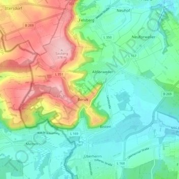
Name: Berus topographic map, elevation, terrain.
Location: Berus, Überherrn, Landkreis Saarlouis, Saarland, Deutschland (49.25080 6.66009 49.28502 6.75586)
Average elevation: 820 ft
Minimum elevation: 614 ft
Maximum elevation: 1,240 ft
Other topographic maps
Click on a map to view its topography, its elevation and its terrain.
Wohnstadt
Deutschland > Saarland > Überherrn
Wohnstadt, Überherrn, Landkreis Saarlouis, Saarland, Deutschland
Average elevation: 758 ft