
Itterbeek topographic map
Interactive map
Click on the map to display elevation.
About this map
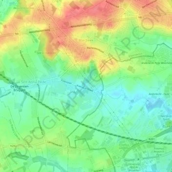
Name: Itterbeek topographic map, elevation, terrain.
Average elevation: 167 ft
Minimum elevation: 75 ft
Maximum elevation: 289 ft
Other topographic maps
Click on a map to view its topography, its elevation and its terrain.
Kattebroek
België > Vlaams-Brabant > Halle-Vilvoorde > Dilbeek
Kattebroek, Dilbeek, Halle-Vilvoorde, Vlaams-Brabant, Vlaanderen, 1702, België
Average elevation: 190 ft