
巍山县 topographic map
Interactive map
Click on the map to display elevation.
About this map
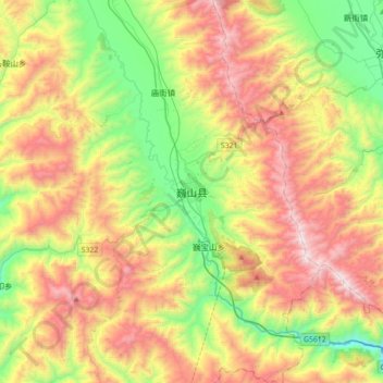
Name: 巍山县 topographic map, elevation, terrain.
Location: 巍山县, 南诏镇, 巍山彝族回族自治县, 大理白族自治州, 云南省, 中国 (25.07031 100.14533 25.39031 100.46533)
Average elevation: 6,998 ft
Minimum elevation: 4,810 ft
Maximum elevation: 9,902 ft