
Maiori topographic map
Interactive map
Click on the map to display elevation.
About this map
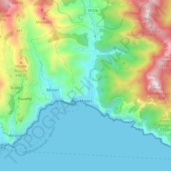
Name: Maiori topographic map, elevation, terrain.
Location: Maiori, Salerno, Campanie, 84019, Italie (40.63284 14.62547 40.67563 14.70379)
Average elevation: 902 ft
Minimum elevation: -13 ft
Maximum elevation: 3,268 ft