
Thank you for supporting this site ❤️
Make a donation
Make a donation
Gear up for your next adventure:
As an Amazon Associate, this site earns from qualifying purchases at no extra cost to you.
雾里 topographic map
Click on the map to display elevation.
Thank you for supporting this site ❤️
Make a donation
Make a donation
Gear up for your next adventure:
As an Amazon Associate, this site earns from qualifying purchases at no extra cost to you.
About this map
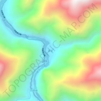
Name: 雾里 topographic map, elevation, terrain.
Location: 雾里, 贡山独龙族怒族自治县, 怒江傈僳族自治州, 云南省, 中国 (28.04001 98.58026 28.08001 98.62026)
Average elevation: 6,913 ft
Minimum elevation: 5,052 ft
Maximum elevation: 9,931 ft
Thank you for supporting this site ❤️
Make a donation
Make a donation
Gear up for your next adventure:
As an Amazon Associate, this site earns from qualifying purchases at no extra cost to you.