
Weststadt topographic map
Interactive map
Click on the map to display elevation.
About this map
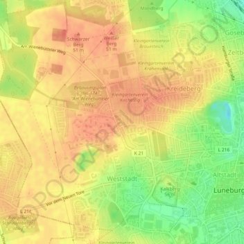
Name: Weststadt topographic map, elevation, terrain.
Location: Weststadt, Lüneburg, Niedersachsen, Deutschland (53.24274 10.36439 53.26970 10.40084)
Average elevation: 121 ft
Minimum elevation: 16 ft
Maximum elevation: 174 ft
Other topographic maps
Click on a map to view its topography, its elevation and its terrain.
Oedeme
Deutschland > Niedersachsen > Lüneburg > Lüneburg
Oedeme, Lüneburg, Niedersachsen, Deutschland
Average elevation: 115 ft
Ebensberg
Deutschland > Niedersachsen > Lüneburg > Lüneburg
Ebensberg, Lüneburg, Niedersachsen, Deutschland
Average elevation: 102 ft