
Bukit Jembalang topographic map
Interactive map
Click on the map to display elevation.
About this map
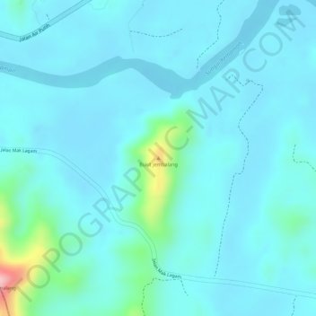
Name: Bukit Jembalang topographic map, elevation, terrain.
Average elevation: 85 ft
Minimum elevation: 3 ft
Maximum elevation: 600 ft
Other topographic maps
Click on a map to view its topography, its elevation and its terrain.
Sungai Teluk Kalong
Malaysia > Terengganu > Kemaman District > Chukai
Sungai Teluk Kalong, Chukai, Kemaman District, Terengganu, Malaysia
Average elevation: 43 ft