
Tuluá topographic map
Interactive map
Click on the map to display elevation.
About this map
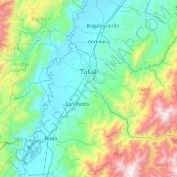
Name: Tuluá topographic map, elevation, terrain.
Location: Tuluá, Centro, Valle del Cauca, 763021, Colombia (3.88852 -76.31391 4.18565 -75.82016)
Average elevation: 5,102 ft
Minimum elevation: 2,999 ft
Maximum elevation: 12,769 ft