
San Juan de Colón topographic map
Interactive map
Click on the map to display elevation.
About this map
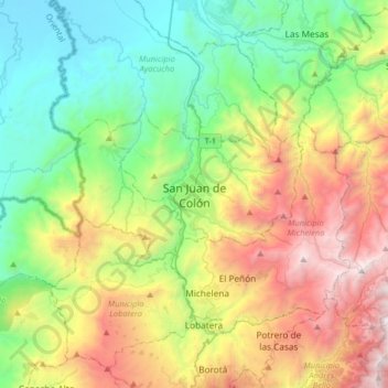
Name: San Juan de Colón topographic map, elevation, terrain.
Average elevation: 3,445 ft
Minimum elevation: 230 ft
Maximum elevation: 9,462 ft
Other topographic maps
Click on a map to view its topography, its elevation and its terrain.
San Pedro del Río
Venezuela > Estado Táchira > Municipio Ayacucho
San Pedro del Río, Parroquia San Pedro del Río, Municipio Ayacucho, Estado Táchira, Venezuela
Average elevation: 3,488 ft