Geolocate

Atatürk Kent Ormanı topographic map

Interactive map

Click on the map to display elevation.

About this map

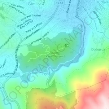
Name: Atatürk Kent Ormanı topographic map, elevation, terrain.

Location: Atatürk Kent Ormanı, Gümüştepe Mahallesi, Nilüfer, Bursa, Marmara Region, Turkey (40.17813 28.97684 40.19176 28.99823)

Average elevation: 781 ft

Minimum elevation: 394 ft

Maximum elevation: 2,044 ft

Other topographic maps

Click on a map to view its topography, its elevation and its terrain.

Nilüfer

Turkey > Nilüfer

Nilüfer, Bursa, Marmara Region, Turkey

Average elevation: 1,391 ft

Barış Mahallesi

Turkey > Nilüfer

Barış Mahallesi, Nilüfer, Bursa, Marmara Region, Turkey

Average elevation: 394 ft