Charca Verde topographic map
Interactive map
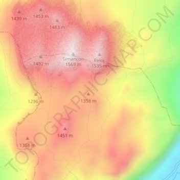
Click on the map to display elevation.
About this map
Name: Charca Verde topographic map, elevation, terrain.
Average elevation: 4,196 ft
Minimum elevation: 2,710 ft
Maximum elevation: 5,085 ft

Click on the map to display elevation.
Name: Charca Verde topographic map, elevation, terrain.
Average elevation: 4,196 ft
Minimum elevation: 2,710 ft
Maximum elevation: 5,085 ft