Geolocate

Elevation topographic map

Click on the map to display elevation.

About this map

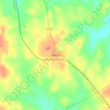
Name: Elevation topographic map, elevation, terrain.

Location: Elevation, Milam County, Texas, United States (30.63353 -96.83887 30.67353 -96.79887)

Average elevation: 492 ft

Minimum elevation: 410 ft

Maximum elevation: 561 ft

Milam County trails, hiking, mountain biking, running and outdoor activities

Other topographic maps

Click on a map to view its topography, its elevation and its terrain.

Rockdale

United States > Texas > Milam County

Average elevation: 482 ft

Milano

United States > Texas > Milam County

Average elevation: 489 ft

Cameron

United States > Texas > Milam County

Average elevation: 381 ft

Gear up for your next adventure:

🛠️Outdoor Gear Repair Kit - Essential tools to fix gear on the trail
🧭Hiking Compass - Precision compass for reliable navigation in the wilderness
🏫Relief Map Kits - Hands-on tools for teaching landforms and elevation
🌲Outdoor Survival Books - Best books on survival skills
👖Convertible Hiking Pants - Versatile zip-off pants for changing altitudes and temperatures

As an Amazon Associate, this site earns from qualifying purchases at no extra cost to you.