
Piñuécar-Gandullas topographic map
Interactive map
Click on the map to display elevation.
About this map
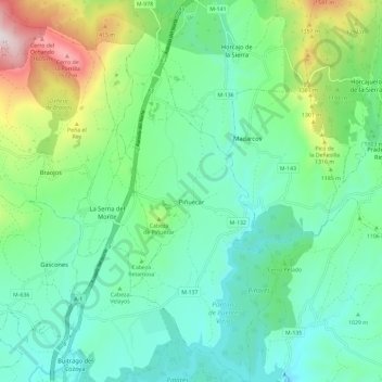
Name: Piñuécar-Gandullas topographic map, elevation, terrain.
Location: Piñuécar-Gandullas, Sierra Norte, Comunidad de Madrid, España (40.99130 -3.62235 41.07968 -3.57291)
Average elevation: 3,655 ft
Minimum elevation: 2,979 ft
Maximum elevation: 5,640 ft
Other topographic maps
Click on a map to view its topography, its elevation and its terrain.
Gandullas
España > Comunidad de Madrid > Sierra Norte > Piñuécar-Gandullas
Gandullas, Piñuécar-Gandullas, Sierra Norte, Comunidad de Madrid, 28737, España
Average elevation: 3,337 ft