
Mumpf topographic map
Interactive map
Click on the map to display elevation.
About this map
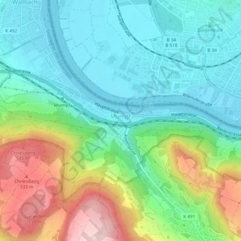
Name: Mumpf topographic map, elevation, terrain.
Location: Mumpf, Bezirk Rheinfelden, Argovie, 4322, Suisse (47.53468 7.89499 47.55501 7.94020)
Average elevation: 1,234 ft
Minimum elevation: 925 ft
Maximum elevation: 1,926 ft