
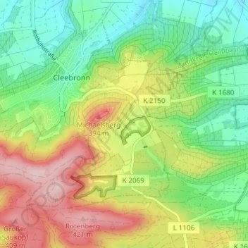
Tripsdrill topographic map
Interactive map
Click on the map to display elevation.
About this map
Name: Tripsdrill topographic map, elevation, terrain.
Average elevation: 965 ft
Minimum elevation: 666 ft
Maximum elevation: 1,398 ft
Other topographic maps
Click on a map to view its topography, its elevation and its terrain.
Michaelsberg
Deutschland > Baden-Württemberg > Landkreis Heilbronn > Cleebronn
Michaelsberg, Cleebronn, Verwaltungsgemeinschaft Brackenheim, Landkreis Heilbronn, Baden-Württemberg, 74389, Deutschland
Average elevation: 997 ft