Geolocate

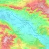
Grohnde topographic map

Click on the map to display elevation.

About this map
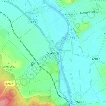
Name: Grohnde topographic map, elevation, terrain.

Location: Grohnde, Emmerthal, Landkreis Hameln-Pyrmont, Lower Saxony, 31860, Germany (51.99879 9.39952 52.03879 9.43952)

Average elevation: 282 ft

Minimum elevation: 213 ft

Maximum elevation: 568 ft

Other topographic maps

Click on a map to view its topography, its elevation and its terrain.
31787

Germany > Lower Saxony > Landkreis Hameln-Pyrmont > Hamelin

Average elevation: 423 ft

Hamelin

Germany > Lower Saxony > Landkreis Hameln-Pyrmont

Average elevation: 400 ft

Hamelin

Germany > Lower Saxony > Landkreis Hameln-Pyrmont

Average elevation: 400 ft

Gear up for your next adventure:

🏕️Family Camping Gear - Essentials for group camping trips
🧦Merino Wool Socks - Moisture-wicking, blister-preventing socks for long treks
⌚Solar GPS Watches - Advanced multisport watches with built-in topographic maps
🧢Sun Protection Hats - Wide-brimmed and UPF-rated hats for high-altitude sun safety
📦Gear Storage Bags - Organize and protect outdoor equipment

As an Amazon Associate, this site earns from qualifying purchases at no extra cost to you.